QuantyPipe
Urban pipeline information system
- No.
- PIPE
- Lineage
- Built on QuantyView 3.0
Urban pipeline information system
QuantyPipe, an urban underground pipeline information system and management service platform, is an integrated technical system developed on the QuantyView platform. It digitizes the acquisition, storage, management, analysis, processing and application of underground pipeline information, significantly raising the level of digitization, networking, informatization, intelligence and visualization in urban management. It provides strong decision support for the safe running of cities and is a powerful tool for "smart city" development and integrated use of urban big data. The system grew out of pilot projects for China's ministry responsible for urban and rural construction, followed by years of continuous development, refinement and improvement. It uses several national invention patents, offers powerful functions and is fully our own intellectual property. It has been applied successfully to integrated pipeline management in Beijing and the Tianjin Binhai New Area.
The system mainly includes: a 2D pipeline management subsystem, a 3D pipeline management subsystem, a 3D geological–geographic modelling and analysis subsystem, an online office and service subsystem, and an intelligent control and early-warning system.
Developed on the QuantyView2D platform. Besides full spatial data handling — data storage and management, data conversion, graphic editing, image processing and coordinate conversion — it provides:
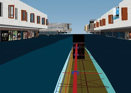
Developed on the QuantyView3D platform, it builds integrated 3D models of underground pipelines, underground buildings and structures, buildings above ground, surface terrain and roads, with professional graphic editing, two-way data queries, 3D fly-throughs and virtual excavation of underground openings. It can create 3D pipelines at specified locations, with computer-aided 3D pipeline design, automatic generation and real-time display; it can take data directly from the 2D system and generate 3D pipeline drawings in real time; and it has common 3D data import interfaces, such as for 3ds Max, for detailed modelling of the urban surface. Users can rotate a full 360 degrees and pan through the 3D pipelines, view them in different views, and display them full screen or zoomed. Spatial objects and their attributes are linked in queries. Users can fly over the whole area by keyboard or along a set path, viewing the landscape and seeing through to the layout of the underground pipelines.
A specialist subsystem, also developed on the QuantyView3D platform. On top of the integrated 3D models of pipelines, underground and above-ground buildings, terrain and roads described above, it adds integrated 3D modelling of the geological bodies and structures below, and supports professional spatial analysis based on the 3D models, cause analysis of ground subsidence and drainage pipe leaks, spatial data mining and spatial decision-making.
The drainage network information system mainly targets urban rainstorm flooding. Based on current rainfall, it calculates in real time where water will pond after a storm and how deep, giving cities a digital tool for flood control and drainage. Its main models are:
Brings government approval of pipeline construction projects and public pipeline information services online. Government agencies use its office modules for project submission and review, helping administrators standardize and digitize their workflows. The public can check notices of water and gas supply interruptions, road works, road flooding and water quality through the public service website, supporting residents' safety and travel planning. The subsystem is also an urban pipeline information service platform: on receiving a forecast or warning, it finds the excavation areas and pipeline owners affected and notifies the owners of planned excavation in that area by SMS, WeChat or phone. The owners then mark the position and route of their pipelines on site and guide the excavation work, effectively preventing accidents.
Using sensors, the Internet of Things and cloud computing, it connects with monitoring systems such as fire alarm, gas alarm, environment and equipment monitoring, security and communication systems, transmitting and fusing their data and extracting information for intelligent monitoring, assessment and early warning of the urban underground pipeline network. In an emergency it supports fast, efficient decision analysis and emergency command to reduce damage from accidents, and supports recovery and reconstruction afterwards.