QuantyHazard
Geological hazard information system
- No.
- HAZARD
- Lineage
- Built on QuantyView 3.0
Geological hazard information system
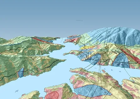
Across China's vast territory, geological hazards of all kinds are frequent and severe, posing a serious threat to lives and property. Landslides and rockfalls are the most frequent and serious, and they also often occur in water conservancy and hydropower projects, urban construction and railway and highway construction. The geological hazard information system (QuantyHazard) collects, manages and permanently preserves geological hazard investigation data scientifically, keeping the information consistent, scientific, current, practical, efficient and shared. It brings computer aid to the whole geological hazard survey (investigation) process: data collection, integrated compilation, data management, data processing, map compilation, 3D modelling, engineering calculation, report writing, analysis and assessment, results management and online publishing. It makes the most of the data, providing data and technical support for analysing and assessing hazardous geological bodies and their risk, monitoring and early warning, remediation works and emergency decisions.
In the field, the system runs a data collection subsystem on ultra-light portable computers and high-performance handhelds; in the office, it runs an integrated compilation and mapping subsystem on desktop computers. Hazard geological spatial and attribute data can be collected in the field and loaded straight into the database, and geological sketch maps revised in one pass. Dynamic data model technology handles the storage and management of multi-source, multi-type, multi-dimensional, multi-scale, multi-temporal and multi-theme data for strata of different regions, ages and types.
Integration of "multi-S" technologies links the computer-aided steps of the geological hazard survey and solves the analysis, synthesis, processing and application of complex geological information. A distinctive dual-body hybrid data model provides integrated storage, management, true 3D modelling and analysis of subsurface–surface, geological–geographic and spatial–attribute data, and can represent fine geological structure.
Compared with similar software, the system has eight distinctive features: