
Features
Quantysoft supported Guizhou's province-wide digital exploration program and built China's first province-wide “Transparent Land” 3D geological model. Since 2019, more than fifty media outlets have reported on it.
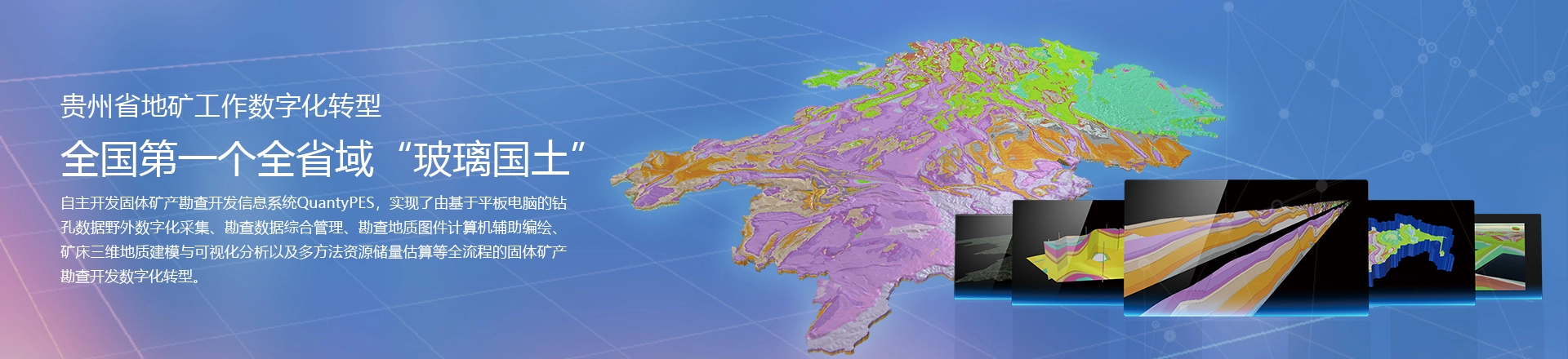
The digital transformation of Guizhou's geological and mineral work
Wuhan Dida Kundi Technology (Quantysoft) gave full support to digital exploration in Guizhou, moving the province's geological and mineral exploration to digital workflows and building China's first province-wide “Transparent Land” model: 176,000 km² made transparent down to 2,500 m below the surface. It set an example in one field for China's national data strategy.
Coverage
- CNR News (cnr.cn)
- Xinhua News
- Science and Technology Daily
- People's Daily Online
- Science and Technology Daily
- China Geological Exploration Net
- China Daily Online
- China News Service
- Ministry of Natural Resources
- Guizhou Provincial Government
- Guangming Online
- Guizhou Provincial Government
More than fifty outlets in all
A digital exploration and mineral prediction system built on geoscience big data
As reported by CNR News, Dongjing Guizhou and others:
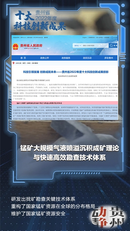
The work won one of Guizhou's Top Ten Scientific and Technological Innovation Achievements of 2022, and was selected as a major technology transfer project to be rolled out across the province.
Since 2018, Zhou Qi's team at the Guizhou Bureau of Geology and Mineral Exploration has refined its original theory of manganese deposits formed by gas-liquid exhalative sedimentation, and proposed that such deposits should have an ore-conducting structure at depth: a channel that carried the manganese up. "To test this, Zhou Qi's team worked with Professor Wu Chonglong of China University of Geosciences (Wuhan), whose group leads the field in China. Big-data 3D geological modelling showed that the large and super-large deposits of eastern Guizhou are controlled not only by the roughly east-west Nanhua rift but also by an older north-west Tongren rift. If a deep manganese channel exists, it should lie where the two structures meet."
Building on this theory, the team fused manganese prospecting with big data and built a 3D solid mineral digital exploration information system with fully independent intellectual property, leading China's move to digital mineral exploration and enabling prediction and efficient exploration of concealed super-large exhalative manganese deposits. Through this work the team discovered and reported four world-class super-large manganese deposits and Asia's largest high-grade manganese deposit in eastern Guizhou. Eastern Guizhou now holds about a third of the world's super-large manganese deposits, changing their global distribution and creating China's largest, and only, world-class manganese resource base.
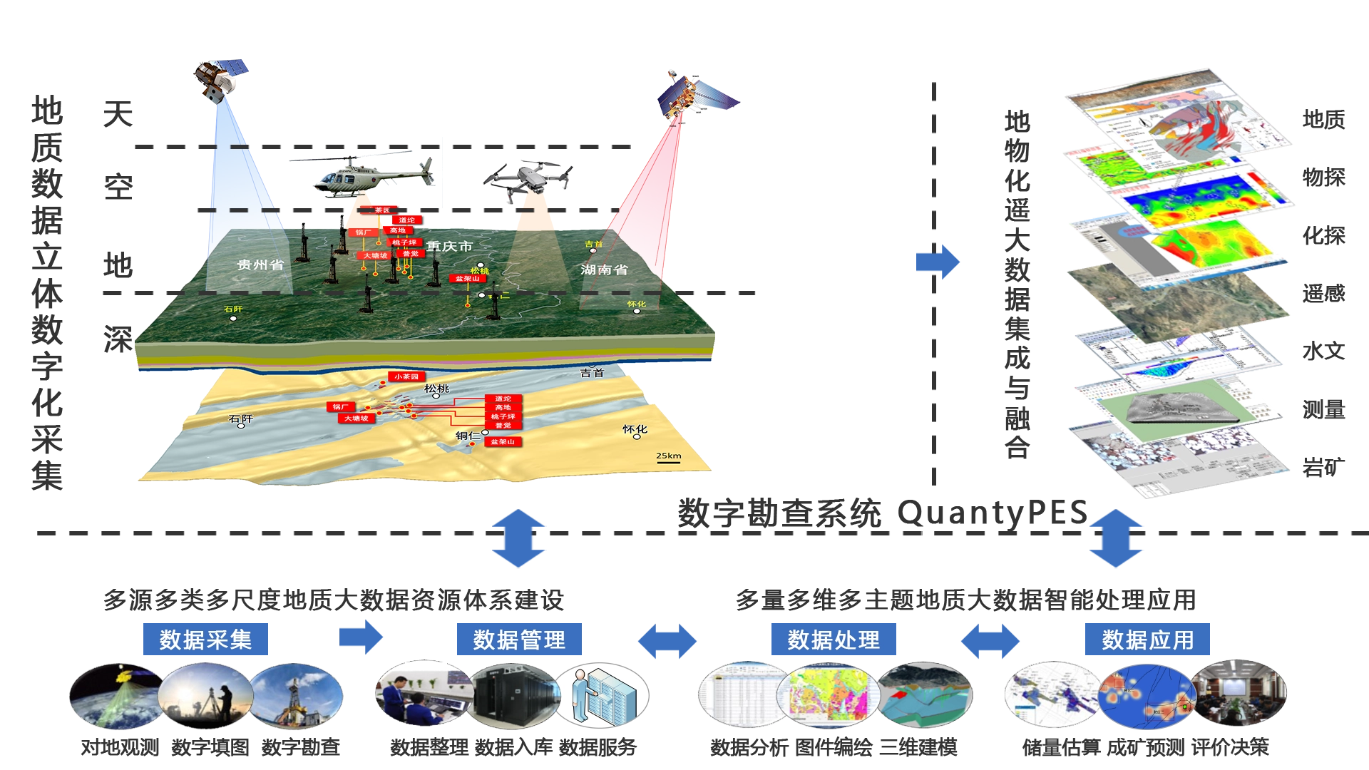
QuantyPES: a 3D solid mineral digital exploration system with fully independent IP
QuantyPES, our in-house solid mineral exploration and development information system, digitizes the entire workflow: tablet-based field collection of borehole data, integrated management of exploration data, computer-aided compilation of exploration maps, 3D geological modelling and visual analysis of ore deposits, and resource and reserve estimation by multiple methods.
See the QuantyPES record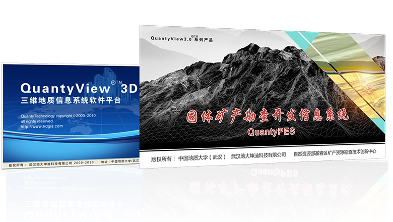
Press pages
Pages and screenshots from some of the coverage, shown as archived on our previous site. The pages are in Chinese.

Page 001Guizhou Provincial Government 
Page 002China Daily · Science and Technology Daily 
Page 003China Natural Resources News · China News Service 
Page 004Xinhua News · Guangming Online 
Page 005Science and Technology Daily · China Mining News 
Page 006China Geological Exploration Net and others 
Page 007Colorful Guizhou (gog.cn) · Guizhou Daily 
Page 008Ministry of Natural Resources · award certificates
Want to see this digital exploration workflow on your own project?
We can walk you through QuantyPES and the 3D modelling workflow for your commodity and exploration stage.
Book a demo